Wednesday, August 15th
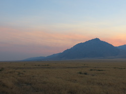
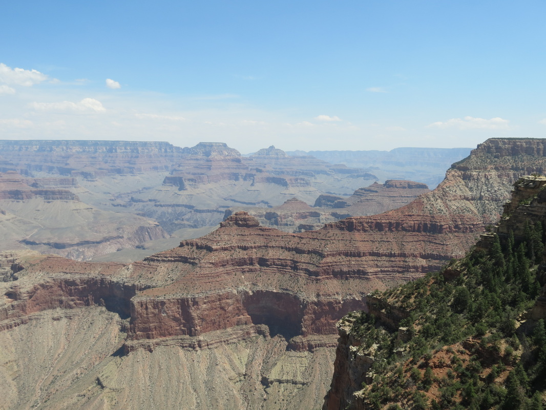
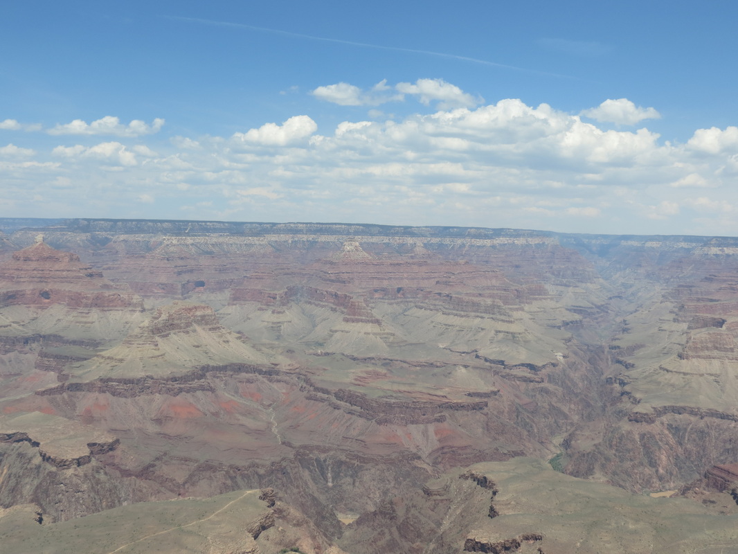
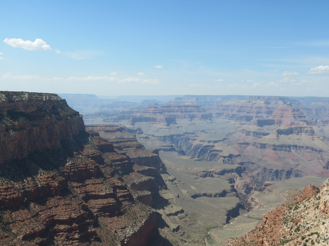
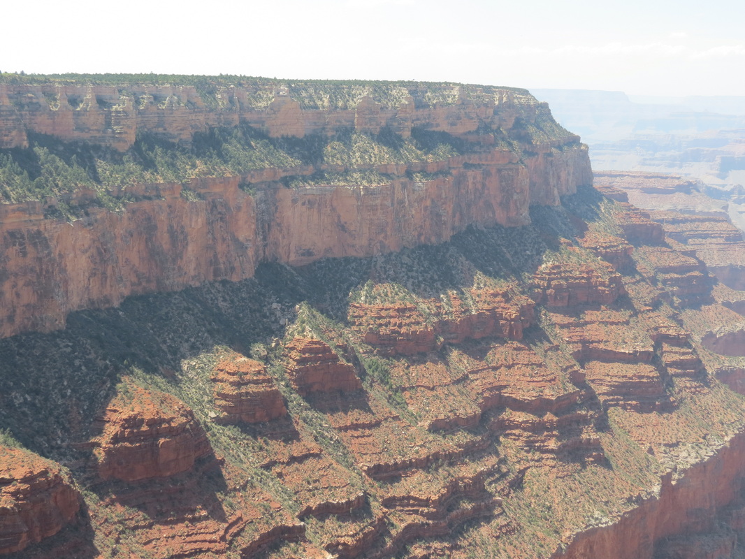
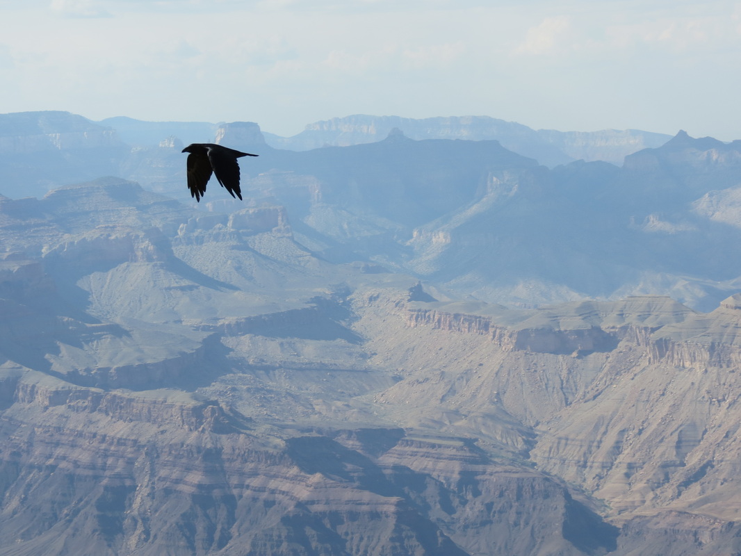
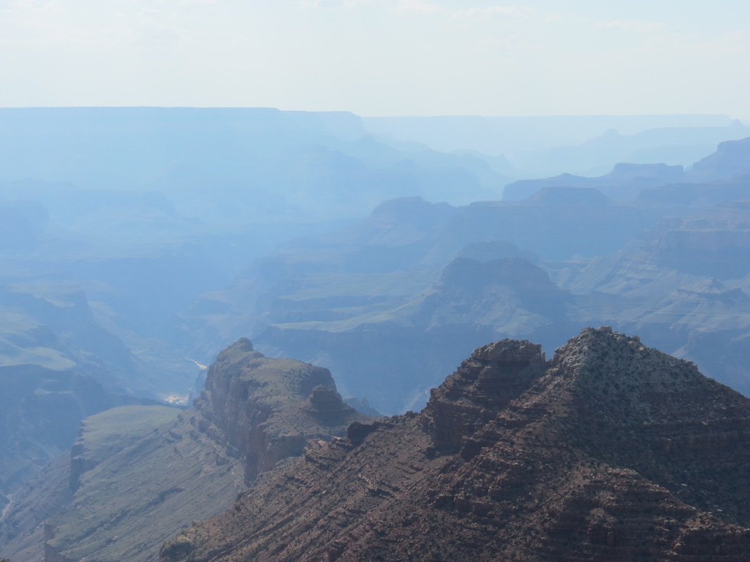
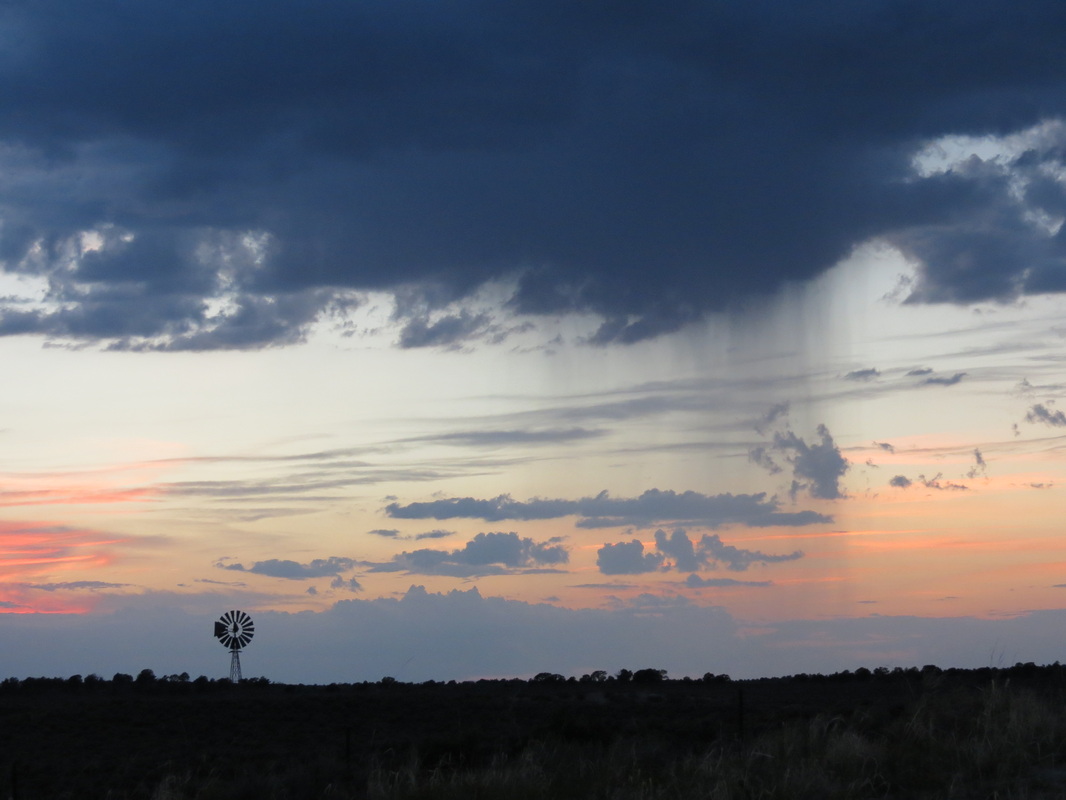
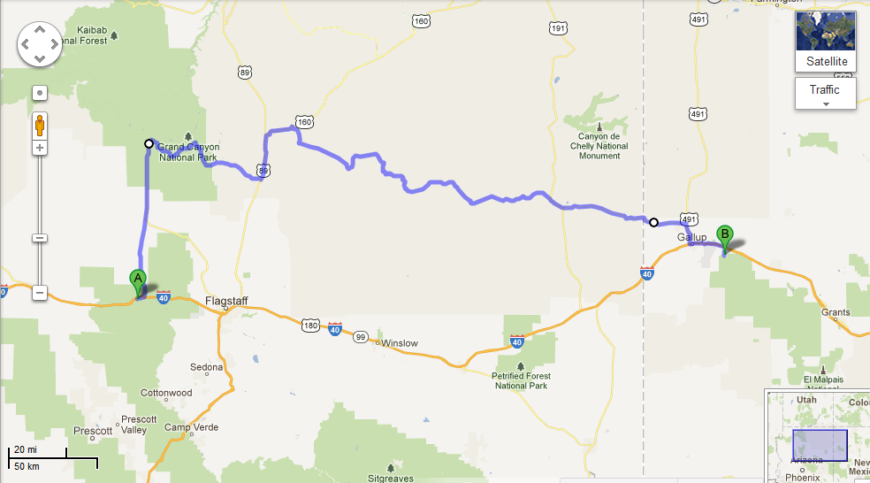
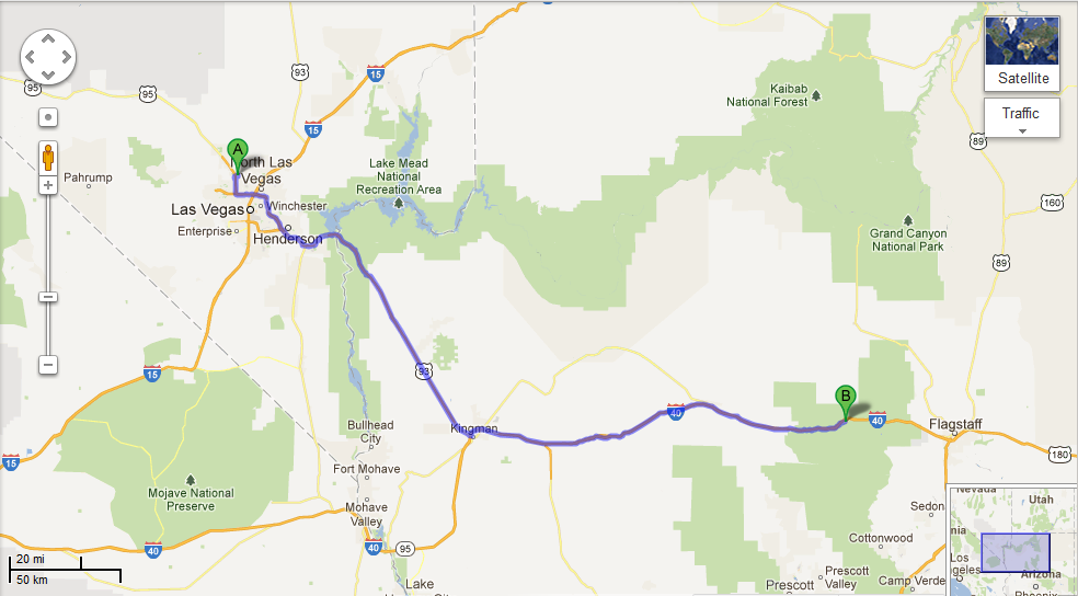
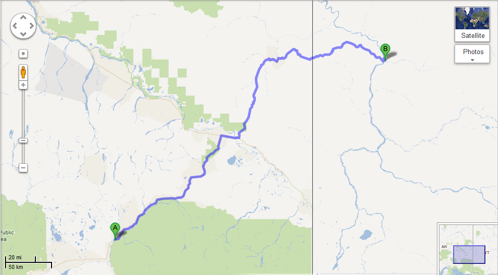
_ Our day started with a walk around downtown Williams along Route 66, which was not quite as happening during the morning as it was the night before, most likely because all of the tourists had already headed out to the Grand Canyon. So, after picking up a few things from Safeway, we followed in their footsteps, ahem, road tracks. Since Chase had spent four months working in the canyon in 2009, he acted as tour guide for the day. We stopped at several scenic viewpoints, but we avoided the overcrowded first view of the canyon at Mather Point and instead spent a while at Yavapai Point and the geology museum there. After cruising around the village, we stopped in at Yavapai Lodge, the hotel where Chase used to work. Luckily, we were able to catch Amy, Chase’s former manager, before she had to run to a Safety Committee meeting. It was great to see Amy again for a couple minutes, but it certainly wasn’t enough time; and ironically, next month she’ll be in Talkeetna while we are both in Tallahassee. 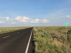 _ At Yavapai, we had to make a decision regarding which route to take: to retrace our morning journey and quickly get back on I-40 or to spend more time driving east in the canyon and take the back roads through the Navajo Nation Reservation. We checked out a few more viewpoints along the rim of the canyon, including Moran Point, the Tusayan Ruins and Museum, the Desert View and Watchtower, and one unnamed overlook where we spent most of the day (at the overlook, we also had the pleasure of overhearing a few conversations, most notably a teenager who wanted to cut down all of the trees so he could see more). Leaving the canyon, we passed a couple of smaller canyons, which were beautiful but certainly not Grand. The roads through Cameron and Tuba City led us past red rocks and into the high plains, which peaked at elevation 7750, not only the highest elevation for the day's drive but also the highest point we have reached on our trip.
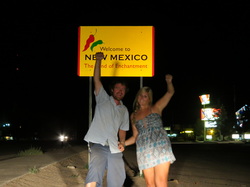
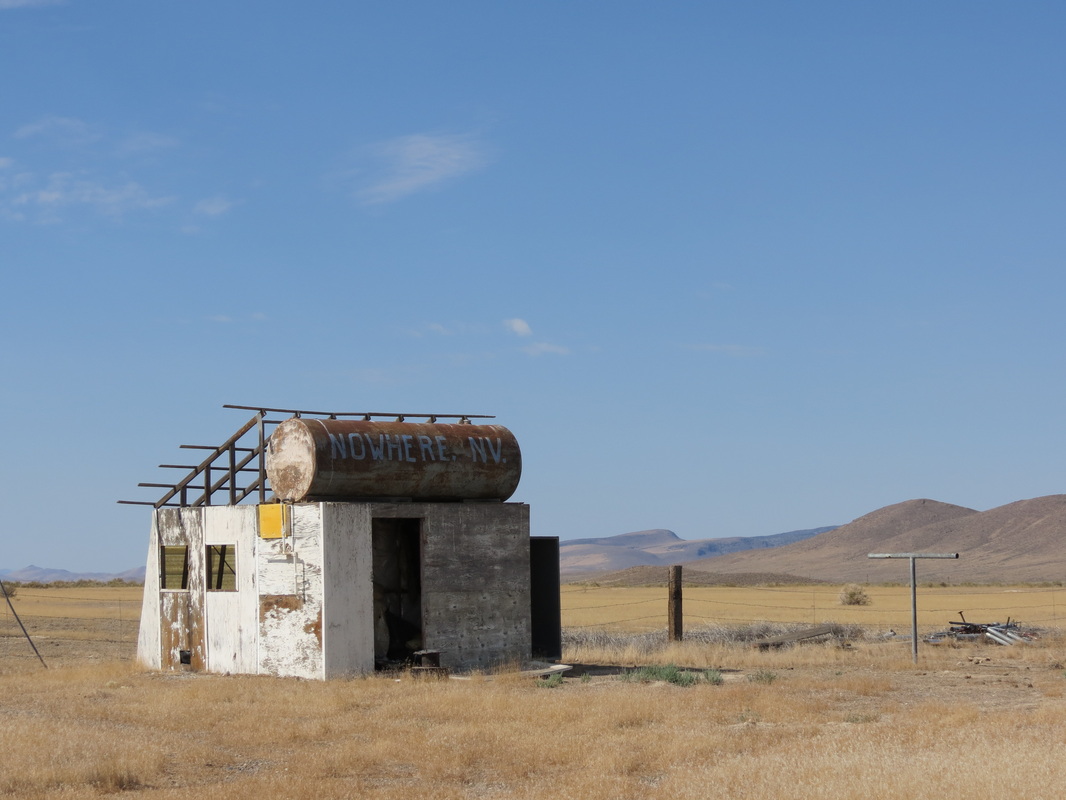
 _ We had stopped in Tuba City for gas, and the gas station attendant had told Chase that highway 264 was a straight shot out into the desert wilderness and camping would be easy along the road. Unfortunately, much to the contrary, the road was notably twisty and curvy around rock formations; this prevented us from making good time and made it harder to eat the ice cream we had bought in Tuba City. Furthermore, the road was very highly populated, with towns every few miles and nowhere to pull off and camp. Because of that we drove later than we normally do, passing into New Mexico after dark to camp in the Cibola National Forest.
 _ “Later” is kind of relative though, because we didn’t exactly have a clear idea of what time it was. Arizona is in Pacific time, though the state does not follow Daylight Savings Time, though the Navajo Nation Reservation does follow Daylight Savings Time, though some towns in the reservation don’t, and then New Mexico is in Mountain Time and is different altogether! Rather than trying to keep it straight, we just set up camp and slept when we were tired.
Tuesday, August 14th
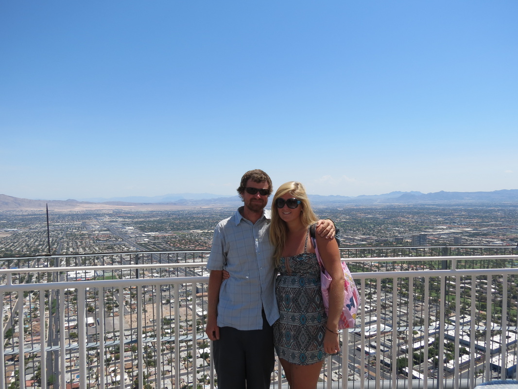
 _ After seeing the view from the tower last night, we wanted to return one more time during the day so that we could see more than just the lights from the Strip. The red mountains surrounding the city and limiting the growth of its sprawl were beautiful juxtaposed against the blue sky, and they are very different from the white mountains Chase is used to seeing in Alaska.
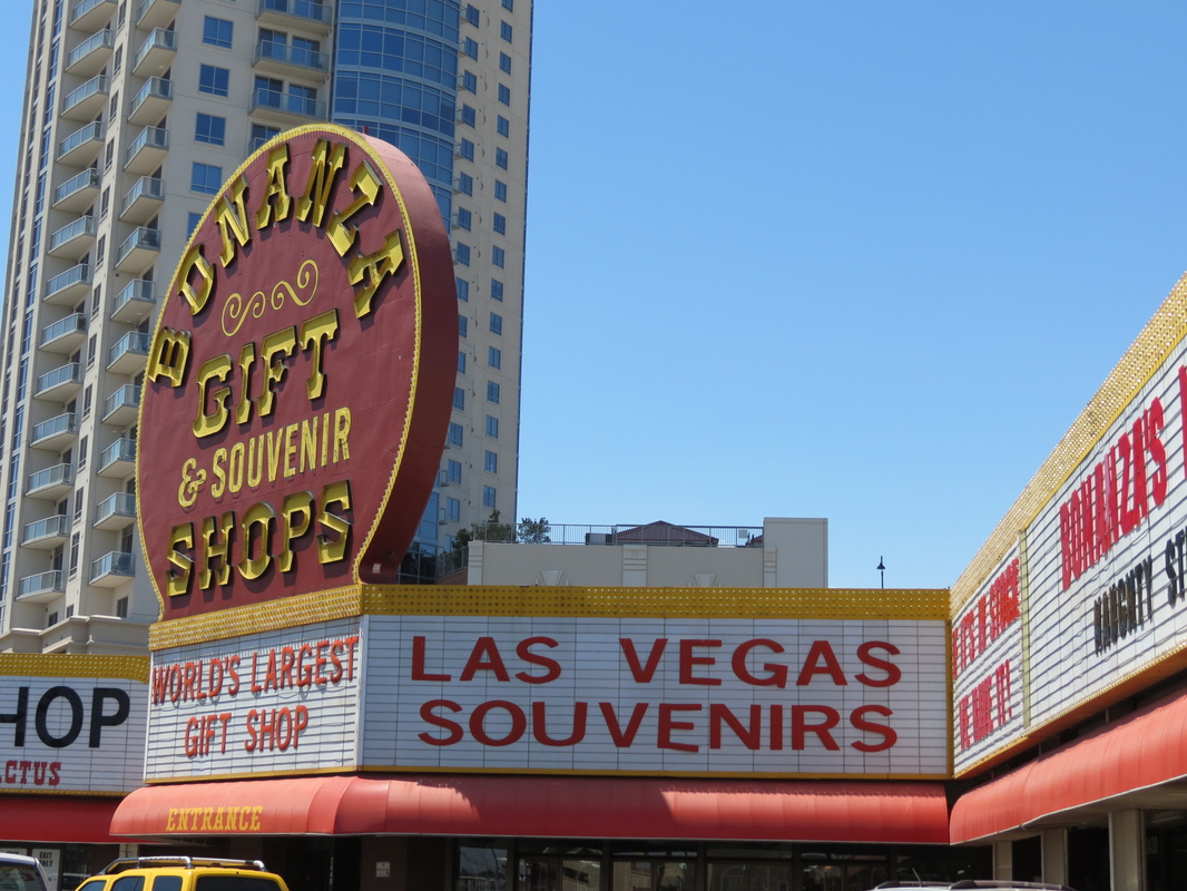
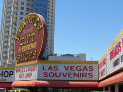 _ Once we finally left our hotel, Charla created a fun challenge for us to attempt. Near the hotel was Bonanza Gifts, the tackiest-looking gift shop on the Strip. We were each going to spend 15 minutes shopping, with a $5 maximum, to buy the other the tackiest item we could find, and we’d have to wear the other’s “gift” at some point during the road trip. Much to our dismay, though the shop was incredibly tacky, it was also shockingly expensive, and we realized that a $5 maximum would not provide for more than a glittery keychain flask. Sadly enough, we decided to scrap the challenge and must rely on our own already tacky wardrobe for the rest of the trip.
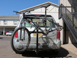 _ Unfortunately, while parked in a lot on the strip, we were approached by our parking lot attendant who notified us that someone had stolen the tire and wheel off of Chase’s bicycle, which was mounted on a bike rack on the Pilot. The parking lot attendant had attempted to stop the man and had called the police, who arrived shortly thereafter. Even more unfortunate, we had seen a man riding a bicycle carrying an extra bicycle wheel a few minutes earlier, but didn’t think much of it. Las Vegas Metro Police have a shockingly quick response time, dispatching two police cars and two police motorcycles to the parking lot, but a brief search failed to turn up the suspect or the wheel. Oddly enough, one of the responding officers notified us that they had recently raised the minimum for petty larceny to $650, which means that in effect it is not a crime to steal tires off of bicycles; if they ever caught the suspect, they’d give him a ticket on par with a ticket for jaywalking. Even so, we filed a police report and the police took pictures, noting the brand and size of the wheel and tire. We can only hope that the wheel happens to find its way into police custody in the next few days, or Chase will be buying a new one in Florida. (In reality, we think that if the motorcycle cops didn’t spot the guy in the first few minutes, the odds of it ever turning up are remarkably slim.)
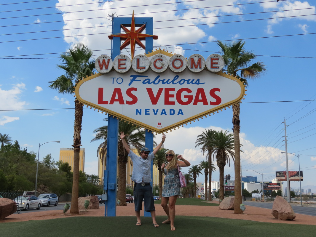
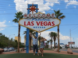 _ Finally making our way out of town, we stopped at the Welcome to Fabulous Las Vegas sign, something we probably would have done a couple days before if it were not on the opposite end of the Strip from where we were staying. We said a quick hello and goodbye to the city of sin (and to an Elvis impersonator taking tourist photos there) and got out. Before we were too far away, we spotted a Jack in the Box, which was offering free chicken nuggets for the people of Las Vegas. We counted ourselves among that crowd for a hot second and took the chicken nuggets to go.
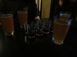
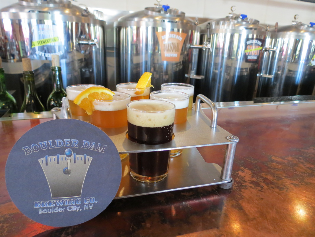
 _ As we made our way to Hoover Dam, a small brewery in Boulder City caught our eyes, so we stopped at the Boulder Dam Brewing Company to try their sample flight, conveniently arranged in the shape of the dam.
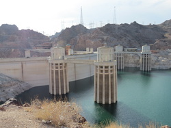 _ Leaving Boulder City, we soon arrived at the Hoover Dam, and the trusty Pilot once again had the pleasure of driving over a massive dam. We stopped for photos on the far side of the dam, as we crossed the Arizona state line, and then we parked the Pilot to walk back into Nevada over the dam.
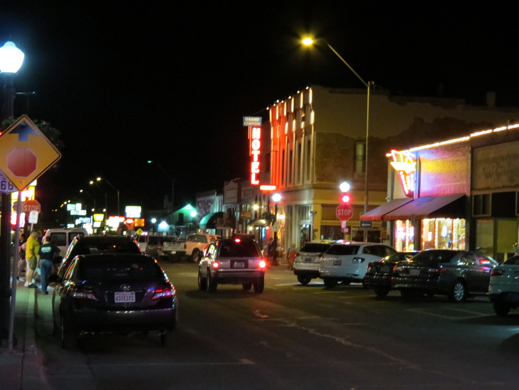
 _ From Hoover Dam, we traveled Highway 93 to I-40 and into the quaint town of Williams, whose main street is the famous Route 66 (we got our kicks!). We had planned to go all the way to the Grand Canyon that night, but Williams captured us, and we decided to stay.
Sunday, August 12th
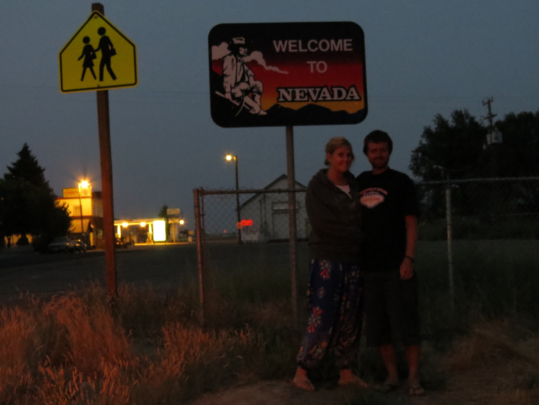
 _ Today was an early day, as we started out hours before the sun rose. We knew it would be a long day of driving, plus we knew it would get hot quick, so there was no reason to dillydally in the tent. A couple hours later we finally hit the Nevada border, right at sunrise.
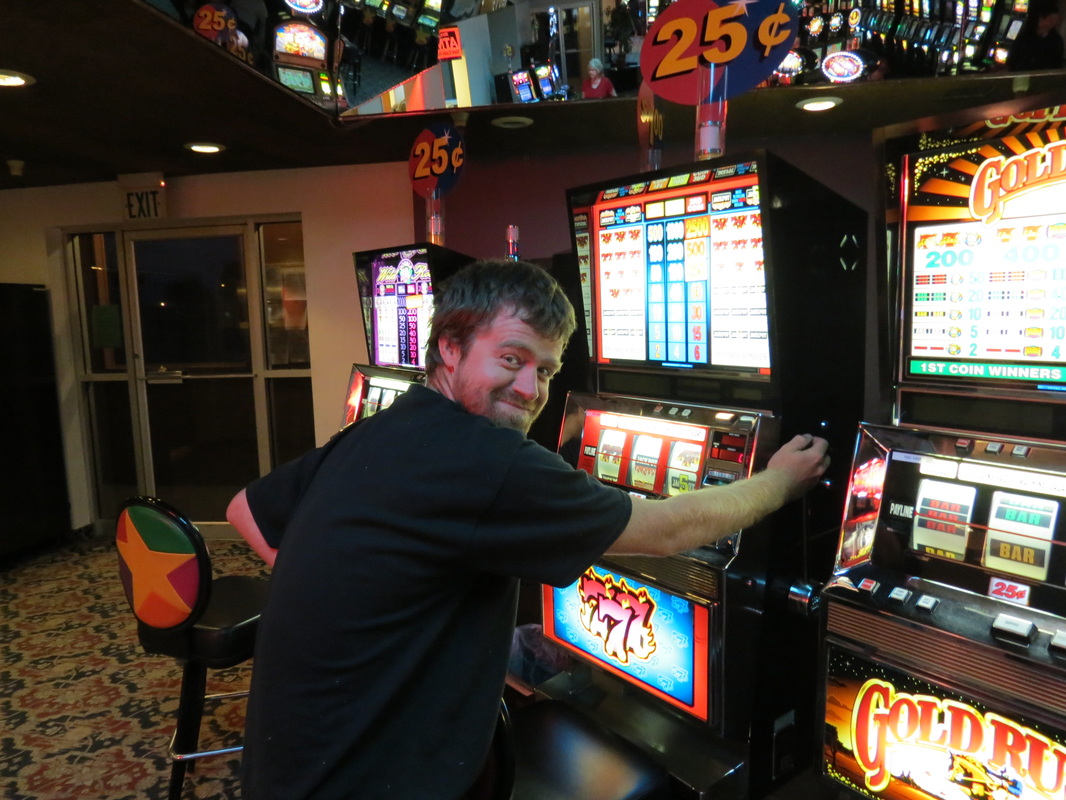
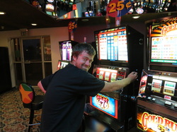 _ . And, as is the state custom in Nevada, there was a scuzzy little gambling hall called the Say When Casino located just feet over the border. The Say When is open 24 hours, and it has 25 cent slots, so to celebrate getting to Nevada we stopped. Even at 6:30 in the morning there was a crowd inside. We walked to the closest slot machines to the door and dropped in our quarters; with Chase’s quarter he won back 50 cents, and is probably the only person in the state of Nevada who is currently 100% ahead in gambling winnings.
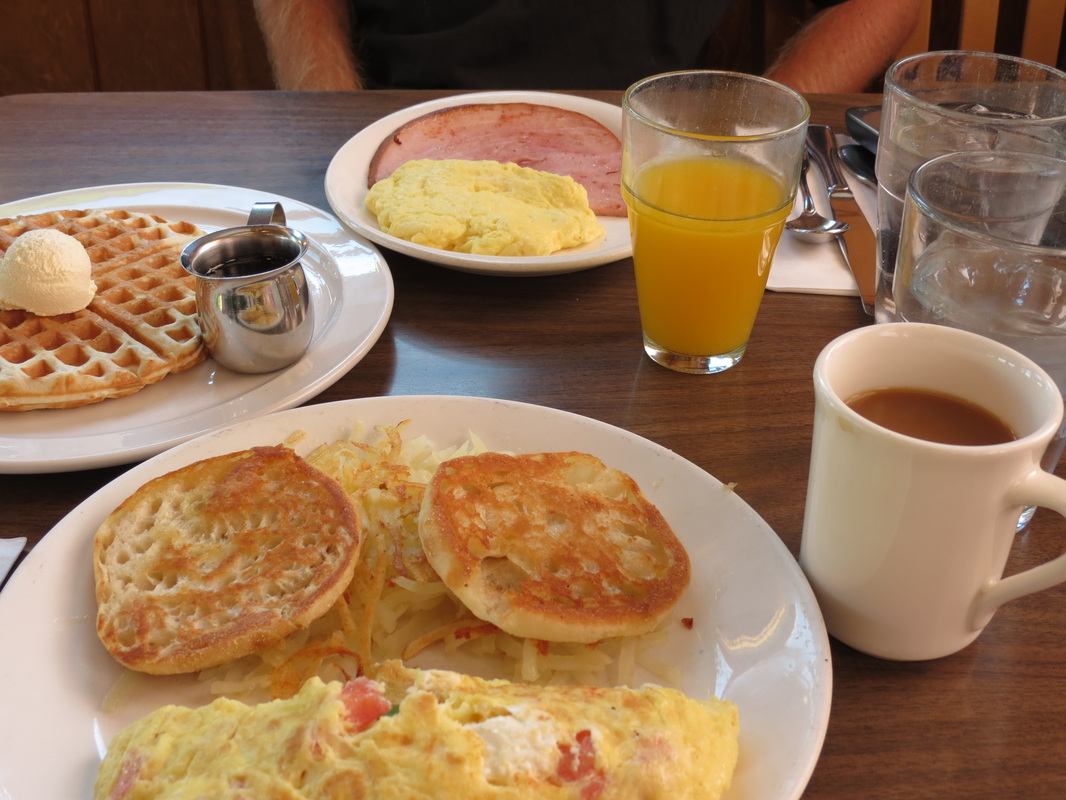
 _ Leaving the Say When we drove for a while as the sun rose, creating a beautiful light in the northern Nevada mountains, until we happened upon The Griddle in Winnemucca. The Griddle was a great old-style American breakfast place, with fresh-squeezed orange juice and great food. We had never thought of mixing up cream cheese in eggs before, but after Charla’s breakfast, it’s definitely an idea we’ll be borrowing.
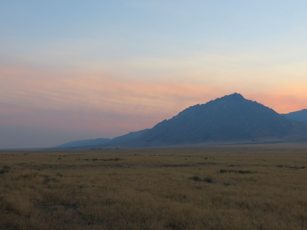
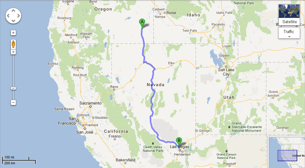
 _ From Winnemucca we jumped on the I-80 for a short hop to Battle Mountain and then took Highway 305 south to Austin. Highway 305 felt like an extremely lonely road, and it didn’t seem that there was any reason for someone to drive it unless they lived or worked out there; and despite a couple ranches and mines, we can only assume very few people lived or worked out there. Ironically, Highway 305 dead-ended into Highway 50, which is billed as the Loneliest Highway in America (despite having more tourist traffic). Highway 50, though, is an amazing road. We immediately entered the town of Austin, which is a quaint little mountain town. Steeped in gold rush (and oddly enough, Pony Express) history, the town was situated at 6,600 feet elevation and when we pulled in the air temperature was exactly 100 degrees. We did the only obvious thing, and stopped at the Toiyabe Café for ice cream.
 _ On our way out of Austin the road started climbing, and climbing, and climbing, until we finally reached Austin Summit at 7,484 feet, which has been our highest elevation of the trip. From there it was all downhill. (Las Vegas is all the way down at 2,181 feet elevation.) Highway 50 to Highway 376 to Tonopoh to Highway 95 to Las Vegas! On the way we passed some sketchy-looking military outposts in the desert, including the alleged Area 51; we also passed Angel’s Ladies, a legal brothel in the desert, though we didn’t want to investigate the quality of the ladies who would choose to work in the rural desert when Las Vegas was less than hour away. Managing to avoid military security, aliens, and prostitutes, we soon found ourselves driving down Las Vegas Boulevard, more popularly known as The Strip.
 _ Pulling into the Stratosphere, we commented that neither one of us could remember the last time we had been in a parking structure so large. The hotel has more than 2,800 rooms, making it approximately ten times the size of the Hotel Alyeska, where Chase works in the winter. Exiting from the parking garage, guests must drag all of their luggage with them from one end of the casino to the other to check-in for the room before dragging all their belongings back across the casino to get to the elevator. There are three elevator banks, depending on which part of the hotel your room is in. We finally found our elevator bank, and sped up to the sixteenth floor for our mountain-view room. We barely left the room, instead relaxing and reveling in the fact that for the first time since July we had walls, electricity, air conditioning, a shower, and a bed.
Friday, August 3rd
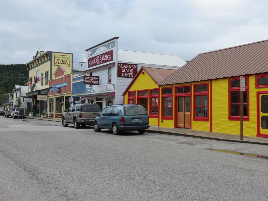
 _ We woke up among the Klondike gold rush-era facades of the Attic, as Freddie’s apartment complex is known among the residents. Once again it was time for more blueberry pancakes using Charla’s blueberries from Talkeetna! (Readers might have noticed that by now they’ve been smuggled across a second international border, so we should get around to eating them.)
 _ After filling up on pancakes we ventured into town to discover that Skagway receives a lot of rain. And wind. And clouds. And 600,000 cruise ship visitors a year in a town of 900 people. Like the cruise ship people, though far more appreciative of their services, we visited the National Parks Service visitors’ center to start our day. After exploring town (which essentially constitutes walking from one end of Broadway to the other) we returned to the Attic for lunch and were pleasantly surprised when Freddie got off of work early and came back to join us.
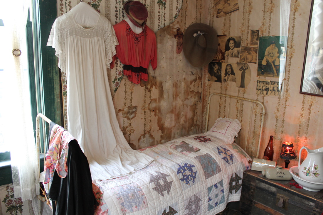
 _ We spent the rainy afternoon getting to know Freddie’s roommates and coworkers, and then ventured back into town for a stop at the local brothel. The Red Onion was Skagway’s brothel back during the gold rush days of the 1890s (and a post office, telegram station, military barracks, etc., before becoming the museum it is today; hence, the 1940's and 50's pinups on the walls), and the fully-functional bar gives tours of the upstairs where the girls never missed a trick. Today it costs $5 to get upstairs for 15 minutes, which is the exact same that it cost in 1899.
 _ Before departing on the trip we had become accustomed to Burger & Brew at the West Rib Pub in Talkeetna on Friday nights, where you get a burger and a PBR for $6.95. We were adrift in Skagway without our Friday night staple, until a whispered rumor sent us to Jewell Gardens for Friday night Hippie Hour where the burgers are $5 and the PBRs are $2. Though an extra nickel changed hands, we were able to keep up the Friday night tradition!
 _ After dinner, we started up a new Friday night tradition at the Skagway Brewing Company. Well, perhaps not a tradition since it won’t happen again, but we all wish it was a tradition. The BrewCo was offering 75 Cent Mystery Shot night, which we descended upon with Freddie and a couple of his roommates. In addition to 75 cent shots, the BrewCo also had its signature Spruce Tip Blonde back on tap, a favorite of ours after sampling a brown and an IPA the night before. After a wild time at the BrewCo (where we were the only table ordering mystery shots and also the only table being wild) we made a quick stop back at the Red Onion. A lowly brothel by day, the RO turns into a dance club at night, luring in the likes of a bachelorette party all the way from Whitehorse.
Wednesday, August 1st
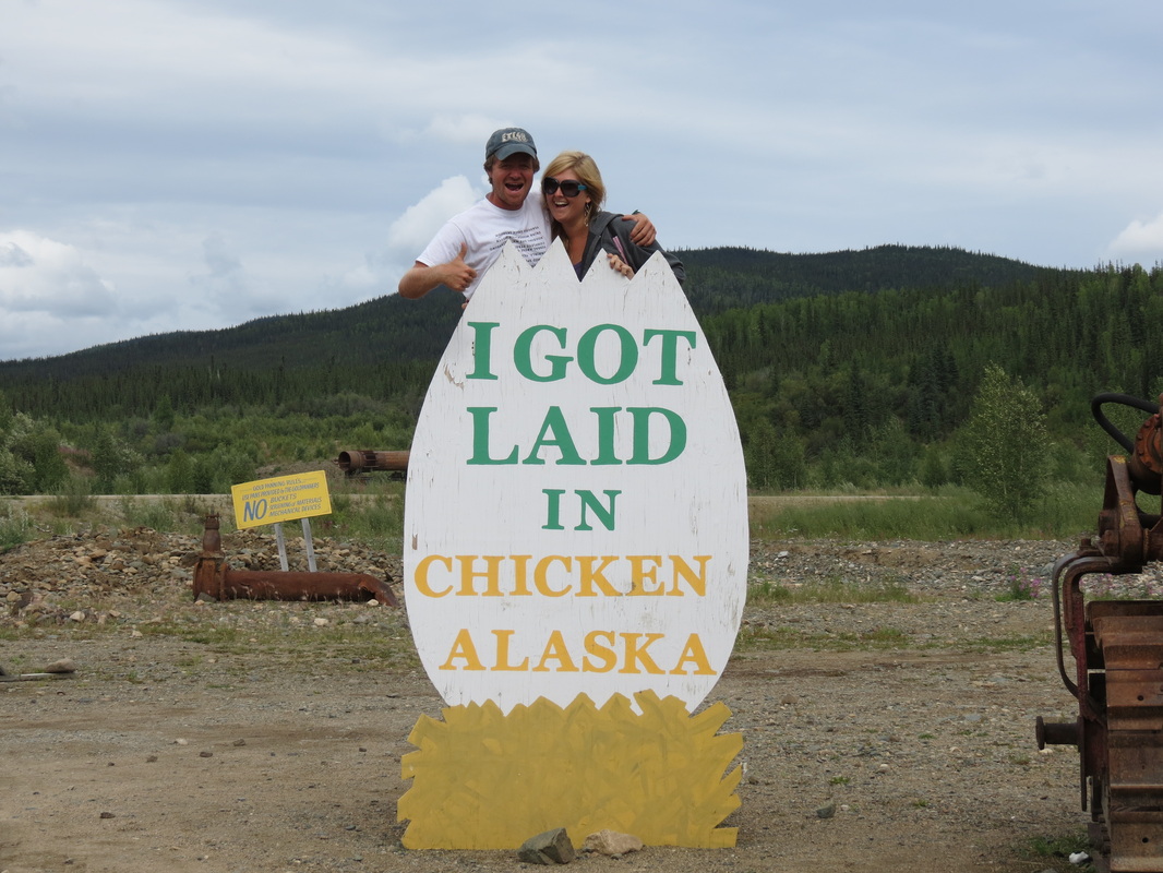
 _ We started the second day of our trip with pancakes made with fresh blueberries and strawberries that Charla picked with Sarah and Logan on Monday afternoon. While Charla was busy at the camp stove, Chase re-packed the Pilot so what we needed was easy to reach and what we didn’t need on this trip (like a snowboard and winter gear) was organized and out of the way. We drove into Tok for gas and some errands, including phone calls before our service cut out (even though Tok is 80 miles from Canada, there isn’t a lot going on in the space between the small town and the border). On the way to Tok, we had a nice surprise and saw a lynx! After ten miles on the Alaska Highway out of Tok, we got on the Taylor Highway to Chicken. Our journey into Chicken started with a big disappointment, as the “Chicken Community” sign formerly covered in an assortment of stickers from travelers had recently been replaced. It was brand spanking new, with the Department of Transportation laminate still peeling off on the corners. Things got better once we got into town, and we got laid in Chicken! We also picked up free chickens that we had earned and met a couple Romanian motorcyclists who were journeying across North America on their own bikes from home. We had one last stop at Downtown Chicken for gas, and luckily for us we paid up and were ready to leave just as two busloads of Princess tourists pulled up to Downtown. The tourists slowly waddled off the bus, cameras in hand, to invade Chicken as we sped out of town.
 _ But we didn’t speed too quickly, as the Taylor Highway ascended up into the mountains and grew increasingly hairy. Just a short time before we passed, a large RV motorcoach with a car in tow had rolled off the side of the mountain and come to rest approximately 150 feet below the road. The Troopers had already cordoned off the scene so we didn’t stop to investigate ourselves, but it didn’t look like a rollercoaster ride we’d have wanted to experience.
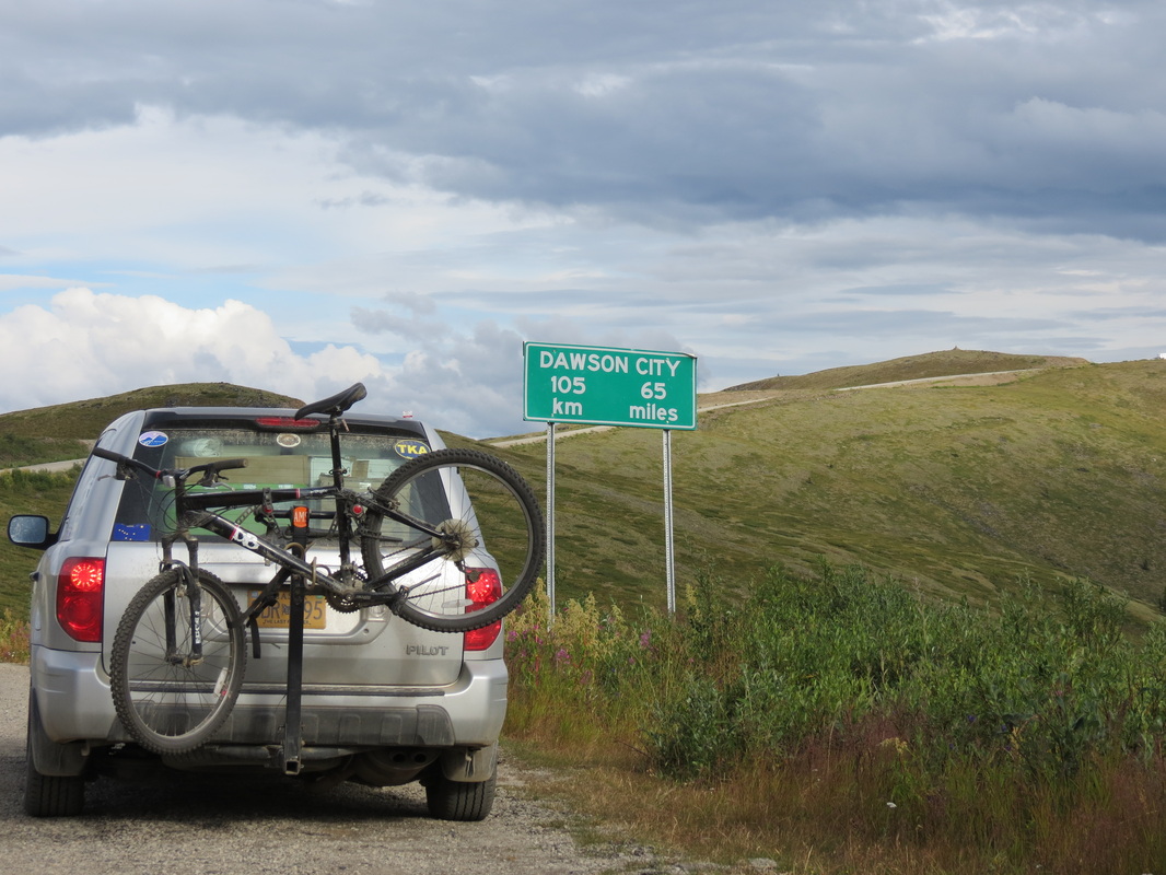
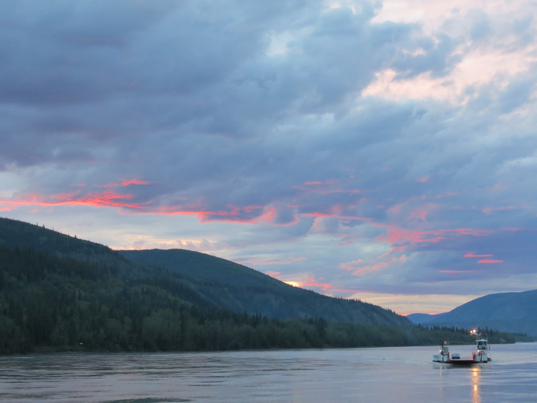
 _ The Taylor Highway becomes the Top of the World Highway as the road becomes Canadian. Luckily we were let across the border without too hard a time from the Canadian Border Security Agent on duty (even though we were smuggling some more of Charla’s freshly-picked berries). We had been foolishly using our time earlier in the day, so we cautiously drove as fast as we dared along the beautiful and treacherous road to Dawson City. Arriving just in time to jump on the George Black, the free ferry across the Yukon River (because the Yukon territorial government hasn’t yet gotten around to building a bridge) we made it to Diamond Tooth Gertie’s just in time for their first can-can show of the evening. Gertie’s is Canada’s oldest casino from before casinos were legal in the Klondike gold rush of the 1890s, and today in addition to gambling Gertie’s offers shows throughout the evening. Told by Diamond Tooth Gertie (the actual proprietor in the 1890s, who actually did have diamonds in her teeth at the time) and her dancing girls, the show tells us how she met Phineas and all the hilarity that ensues. After a dinner between shows at the Triple J Hotel, and the second show at Gertie’s, it was time for one last hop across the ferry to camp in West Dawson.
|


 RSS Feed